


Autel Mapper - Perpetual
Autel Mapper – Perpetual License | Advanced Aerial Mapping Software
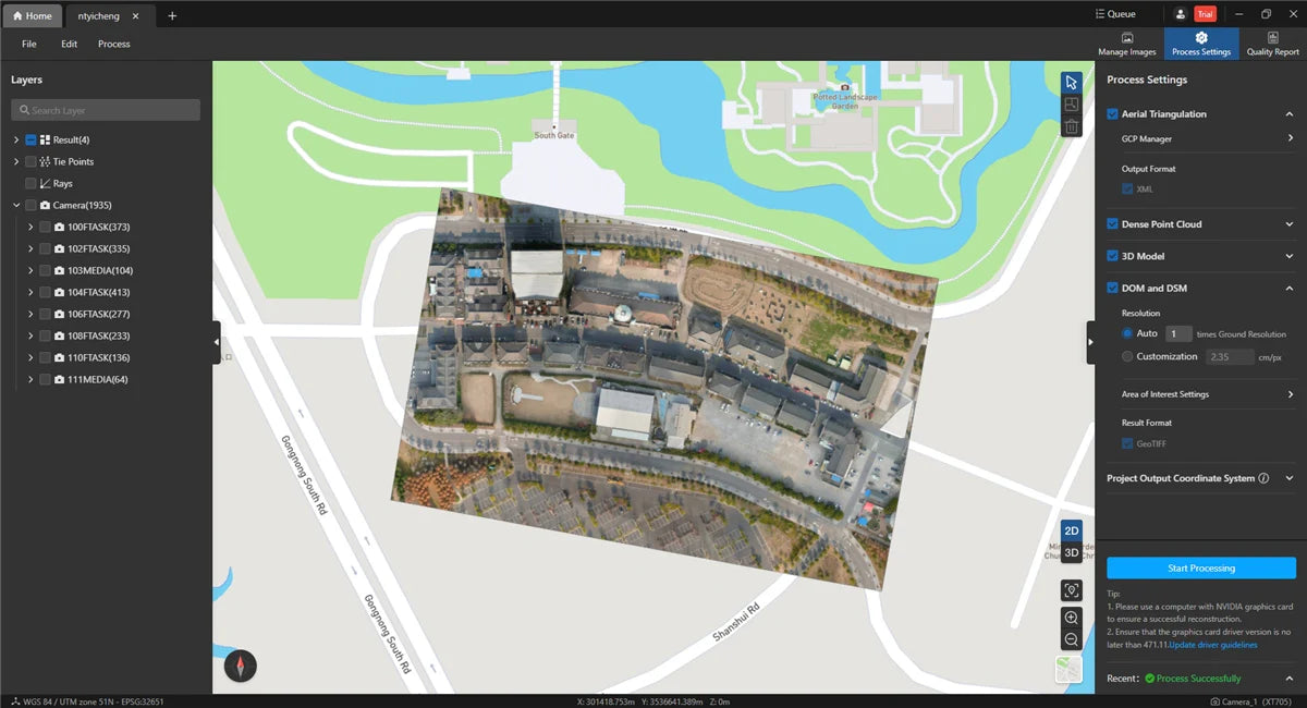
The Autel Mapper – Perpetual license provides a powerful and permanent mapping solution for professionals in surveying, construction, agriculture, and inspection industries. Designed for high-precision aerial data processing, this software transforms drone-captured images into detailed 2D maps and 3D models. With advanced automation, intelligent mapping tools, and seamless compatibility, Autel Mapper ensures efficient and accurate results every time.
Key Features:
- Lifetime Access – The perpetual license grants unlimited access to Autel Mapper without requiring monthly or annual subscriptions. As a result, professionals can enjoy long-term savings.
- High-Precision Mapping – Generate accurate 2D orthomosaics, 3D models and digital elevation maps from drone imagery. This ensures reliable data for various applications.
- Advanced AI Processing – The software uses AI-driven algorithms to process images efficiently while maintaining high accuracy. Therefore, it minimizes manual effort and speeds up project completion.
- Seamless Drone Integration – Autel Mapper works flawlessly with Autel drones, ensuring fast and precise data collection. Because of this, users can optimize their workflow with minimal setup.
- Intelligent Automation – Automated workflows streamline image stitching, processing and analysis, saving time and effort. Consequently, professionals can focus on decision-making rather than manual processing.
- Multiple Output Formats – Export mapping results in various formats, including GeoTIFF, LAS, OBJ, and more. This flexibility allows compatibility with multiple industry software solutions.
- Comprehensive Measurement Tools – Conduct distance, area, and volume calculations with ease for accurate project assessments. As a result, businesses can make data-driven decisions with confidence.
- Offline Processing – Process data without an internet connection, ensuring maximum security and reliability in remote locations. This is especially useful for fieldwork in areas with limited connectivity.
Ideal for Professionals & Businesses
The Autel Mapper – Perpetual license is the perfect tool for surveyors, GIS specialists, construction managers, and agricultural professionals. Because of its advanced mapping features, AI-driven automation, and precision tools, it allows users to analyse, visualize, and optimise projects with confidence.
What’s Included:
- Autel Mapper Software (Perpetual License)
- Full Access to Mapping & 3D Modeling Features
- Regular Updates & Enhancements
- User Manual & Support
Unlock the Full Potential of Aerial Mapping
With the Autel Mapper – Perpetual license, professionals can transform drone imagery into actionable insightswithout recurring fees. Thanks to its intelligent automation, AI-powered processing, and versatile export options, it is the ultimate mapping software for commercial and industrial applications. Start mapping smarter today!