


Autel Mapper – Monthly Subscription
Autel Mapper – Monthly Subscription | Professional Aerial Mapping Software
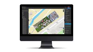
The Autel Mapper – Monthly Subscription offers a flexible and cost-effective solution for professionals in surveying, construction, agriculture, and infrastructure inspection. Designed for high-precision aerial data processing, this software converts drone-captured images into detailed 2D maps and 3D models. Because of its AI-driven automation, intelligent mapping tools, and seamless integration, Autel Mapper ensures fast and accurate results for any project.
Key Features:
- Affordable Monthly Plan – Gain full access to Autel Mapper for a low monthly fee, making it ideal for businesses that need flexibility without long-term commitments. Additionally, this option reduces upfront costs.
- High-Precision Mapping – Generate detailed 2D orthomosaics, 3D models, and digital elevation maps for surveying, planning, and analysis. Therefore, professionals can work with highly accurate data.
- AI-Powered Image Processing – Advanced AI-driven algorithms optimise image processing for higher accuracy and faster results. As a result, users can reduce manual effort and increase productivity.
- Seamless Drone Integration – The software works perfectly with Autel drones, ensuring a smooth workflow and precise data collection. Consequently, users experience minimal setup time and maximum efficiency.
- Intelligent Automation – Autel Mapper automates image stitching, terrain modeling, and data analysis, which saves time on complex mapping tasks. This means professionals can complete projects faster.
- Multiple Export Formats – Processed data can be exported in GeoTIFF, LAS, OBJ, and other industry-standard formats. Therefore, professionals can easily integrate results into their existing workflows.
- Comprehensive Measurement Tools – Measure distances, areas, and volumes with high accuracy. Because of this, businesses can make better decisions in surveying, construction, and land management.
- Secure Cloud Processing – With the monthly subscription, users can take advantage of cloud-based processing, which ensures fast performance and data security without high hardware costs.
Perfect for Professionals & Businesses
The Autel Mapper – Monthly Subscription is ideal for surveyors, GIS specialists, engineers, and agricultural professionals. Because of its affordable pricing, intelligent automation, and precision mapping features, it provides a powerful yet flexible solution for businesses of all sizes.
What’s Included:
- Full Access to Autel Mapper Software (Monthly Subscription)
- All Mapping & 3D Modeling Features
- Regular Software Updates & Enhancements
- Cloud-Based Processing & Data Storage
- User Manual & Support
Get Started with Professional Aerial Mapping
The Autel Mapper – Monthly Subscription allows businesses to access industry-leading mapping technology without a large upfront investment. Thanks to its AI-powered automation, intelligent tools, and seamless integration, users can enhance efficiency and accuracy with ease.
Subscribe today and take your aerial mapping to the next level!